Multi Sensor Object Based Image Classification for Land Use/Land Cover Analysis
In this post, I will share a Land Use Land Cover (LULC) project I did combining multiple sensors. To tackle the common problem of the salt and pepper effect in pixel-based image classification, an object-based approach was chosen for this task. The steps generally involved stacking images from multiple sensors, performing image segmentation using SNIC, taking the mean value of each band from each segment, and running supervised classification using Random Forest.
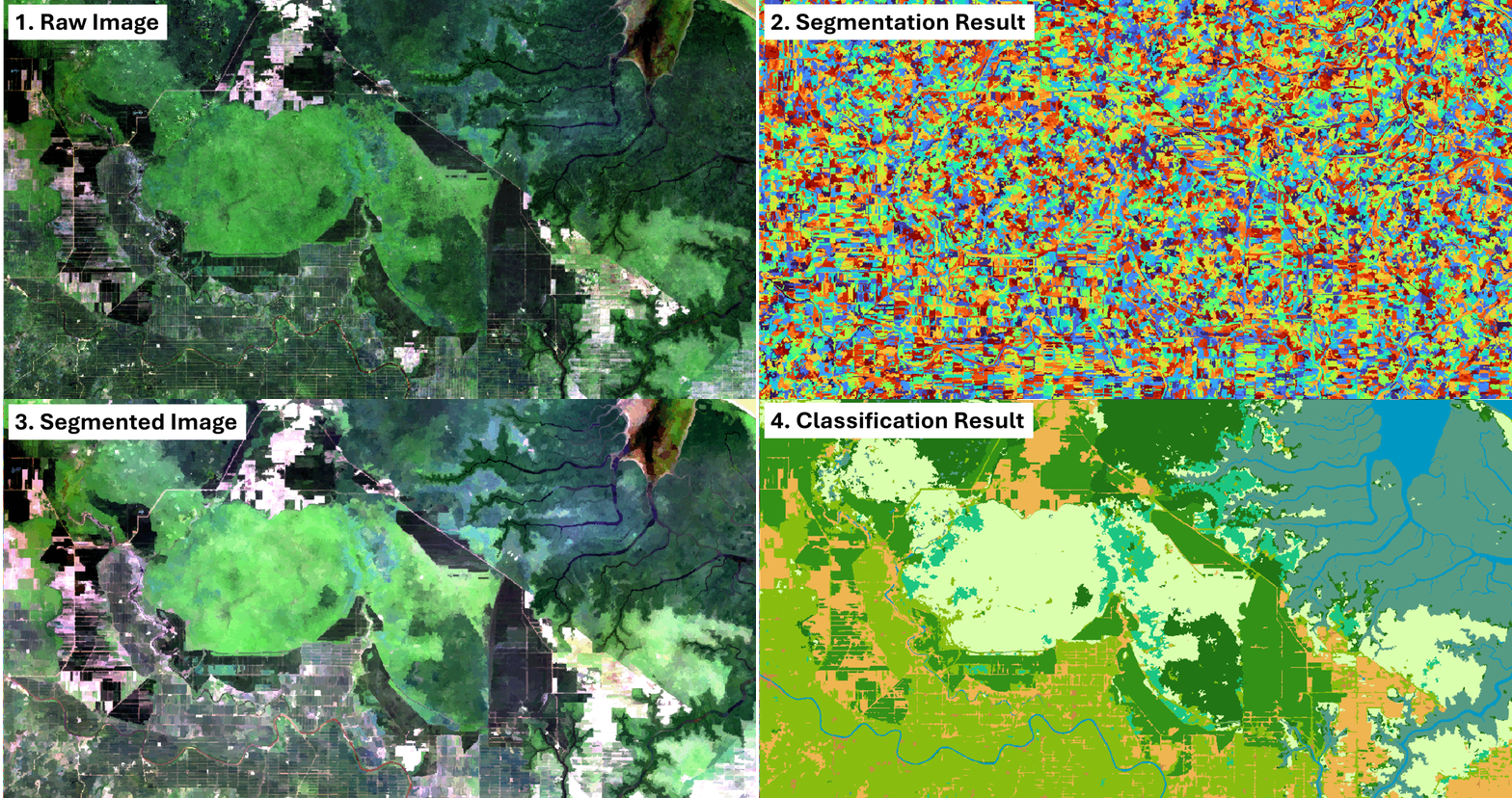
Methods
The land cover classes consist of categories such as forest, shrubs, mangroves, bare land, built-up areas, water, and plantations. Optical and radar images are known to have effective discriminating ability among those classes, which is why we used Landsat-8 and Sentinel-1 sensors. The VIIRS night-time light sensor captures light emissions on the Earth’s surface, which is useful to detect built-up areas. At this stage, we also included elevation data from SRTM, since it was available.
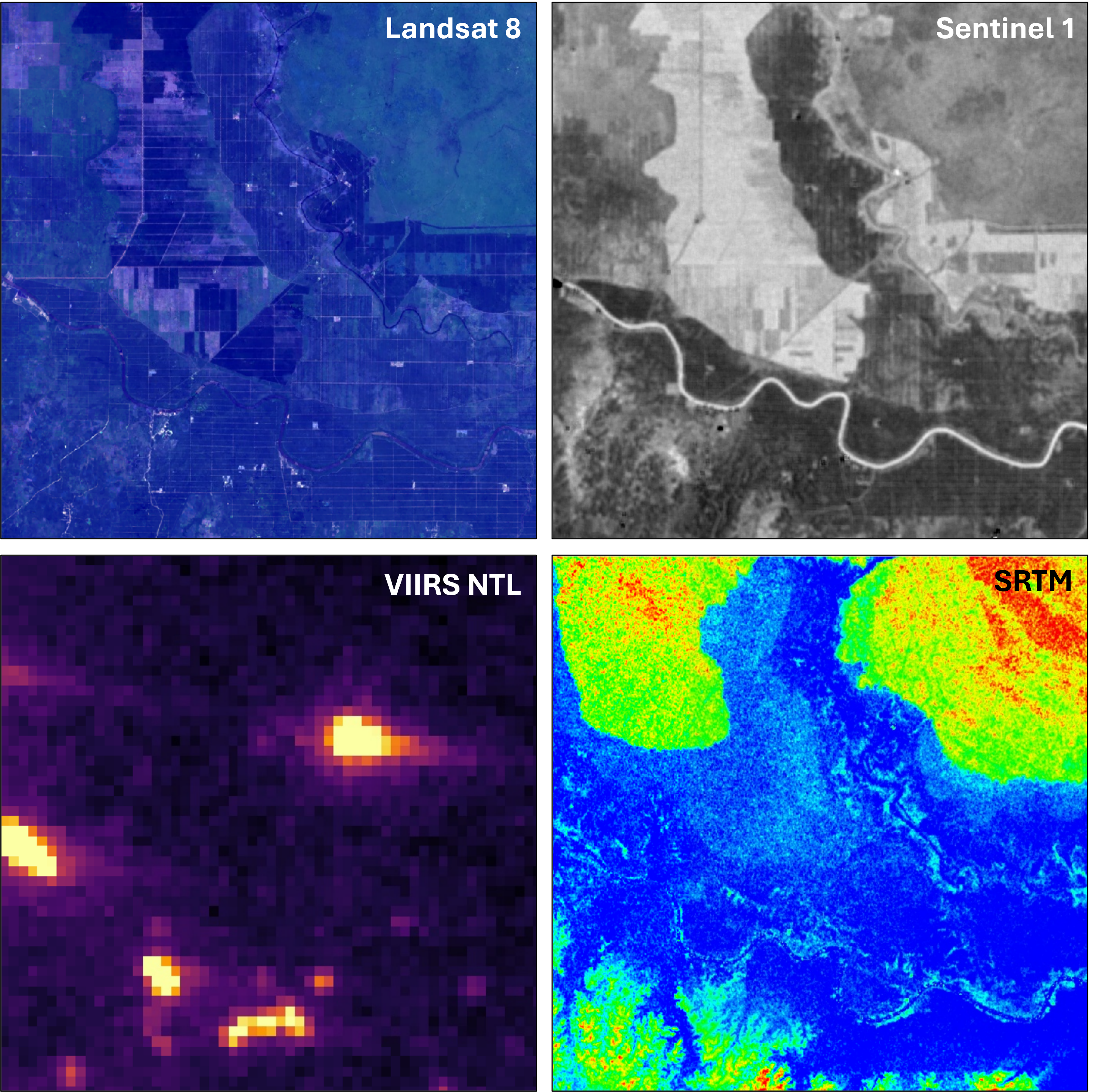
The next step was to extract additional features from the raw data. From the Landsat image, we calculated several spectral indices to highlight different features of the land surface. We also calculated GLCM features to extract textural information. Additionally, we computed band ratios from Sentinel-1 imagery, and we calculated slope from the SRTM elevation data. In total, 27 bands were obtained and prepared as inputs for the classification.
Not all of those bands are useful for the classification purpose, so the next step was feature selection to pick only the most important bands for the final classification. Permutation importance was used for this, which also considers simple correlation between bands. Eight bands were selected for the final classification:
- Modified Normalized Difference Water Index (MNDWI)
- VV/VH Sentinel 1 Ratio
- GLCM Textural Contrast
- Normalized Difference Vegetation Index (NDVI)
- VIIRS Night Light Radiance
- Landsat Band 1
- Build up Index (BI)
Results and Insight
The final result is an annual LULC map of the area. Overall accuracy is around 96%, with most of the errors coming from false positives in palm oil plantations. The palm oil plantations in this region are quite heterogeneous in which some areas are densely planted, while others are more spacious. The more spacious ones often appear similar to shrubs or low canopy forests, which causes confusion.
The model can then be generalized to different timestamps with roughly the same accuracy (94–96%).
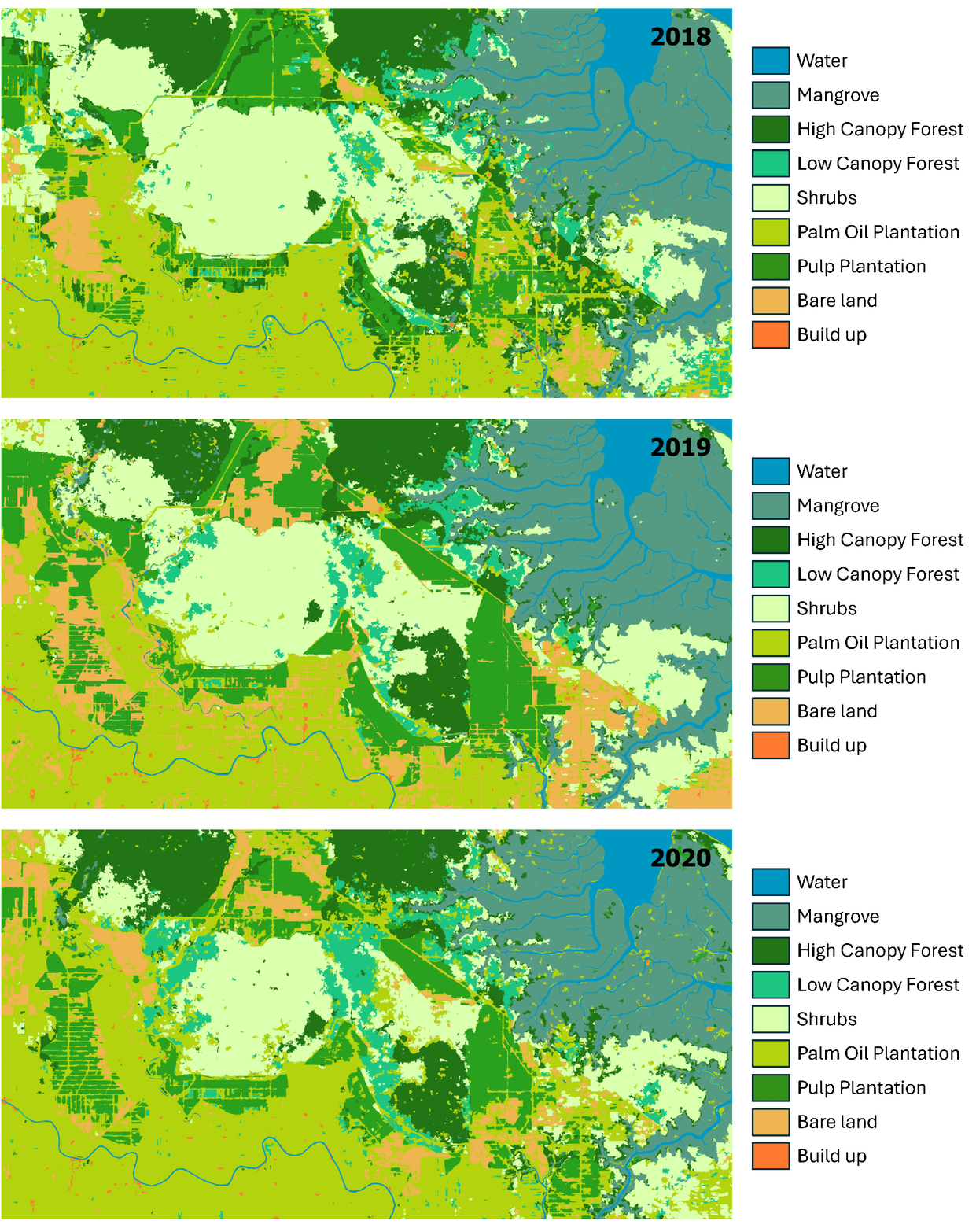
If we look at the results from 2017 to 2024, we can see some interesting trends:
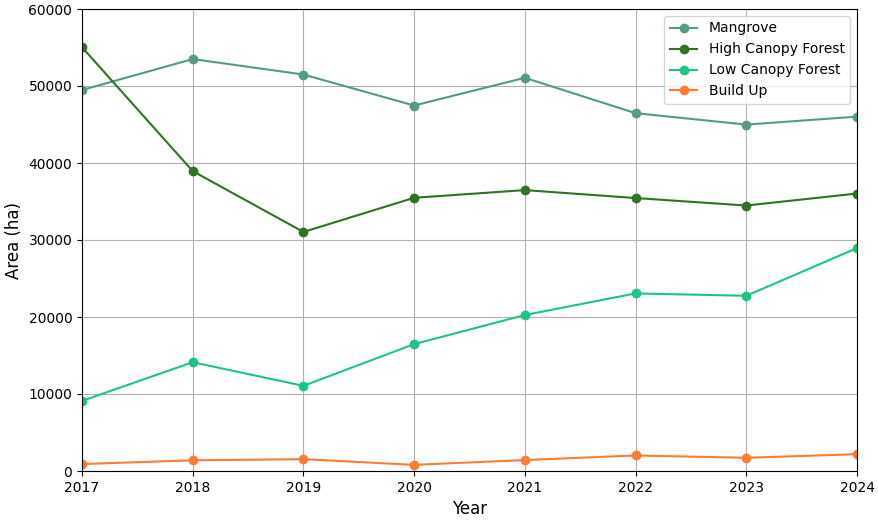
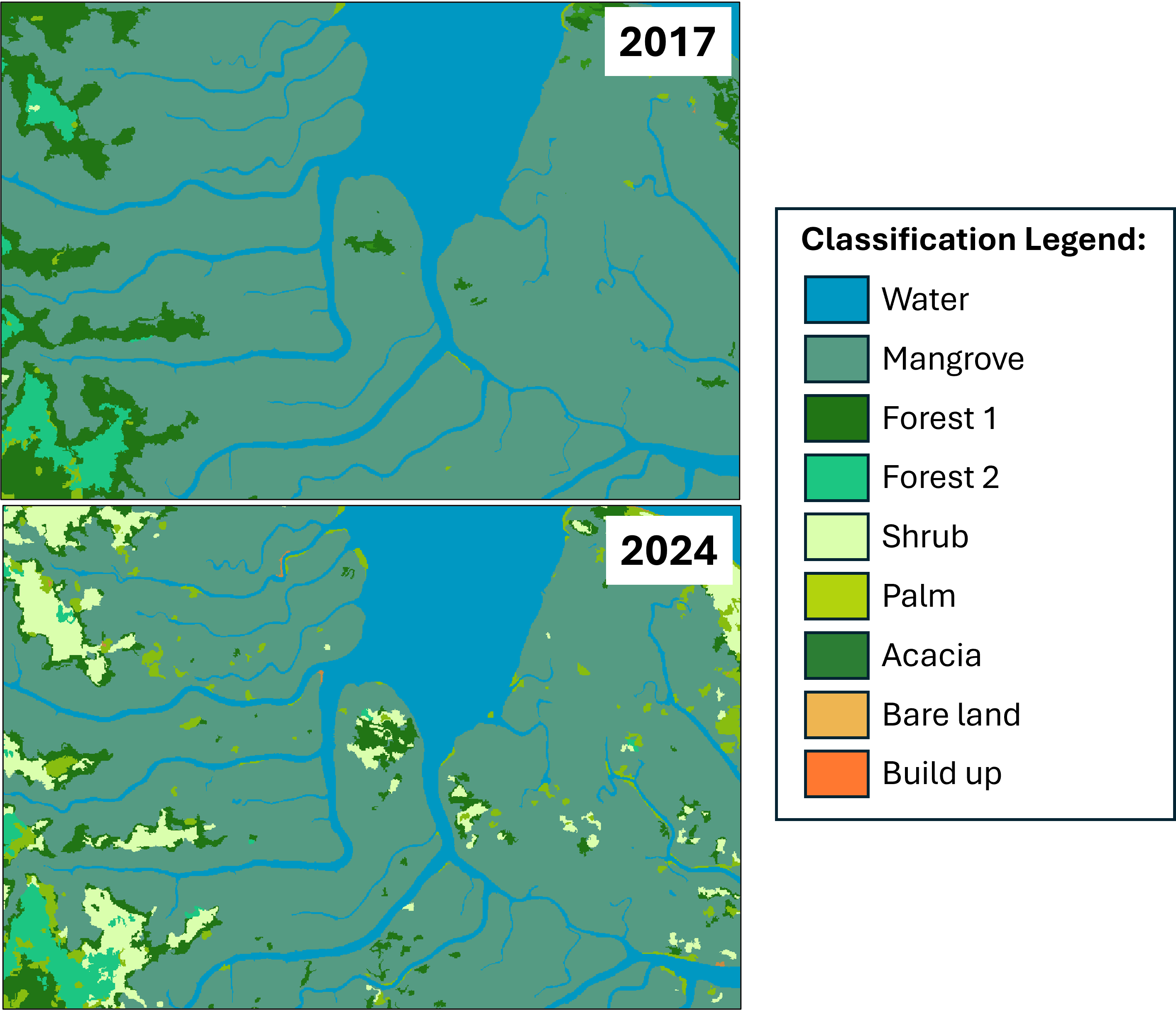
First, there’s a sharp decline in high-density forest from 2017 to 2019, which then stabilizes. We can also see a slow and steady decline in mangroves. Interestingly, for both of these classes, the land cover changes aren’t shifting toward human-made landscapes like built-up areas, plantations, or even bare land. Most of the changes are into shrubs. This might be related to more indirect effects of human activity on the environment rather than direct conversion.
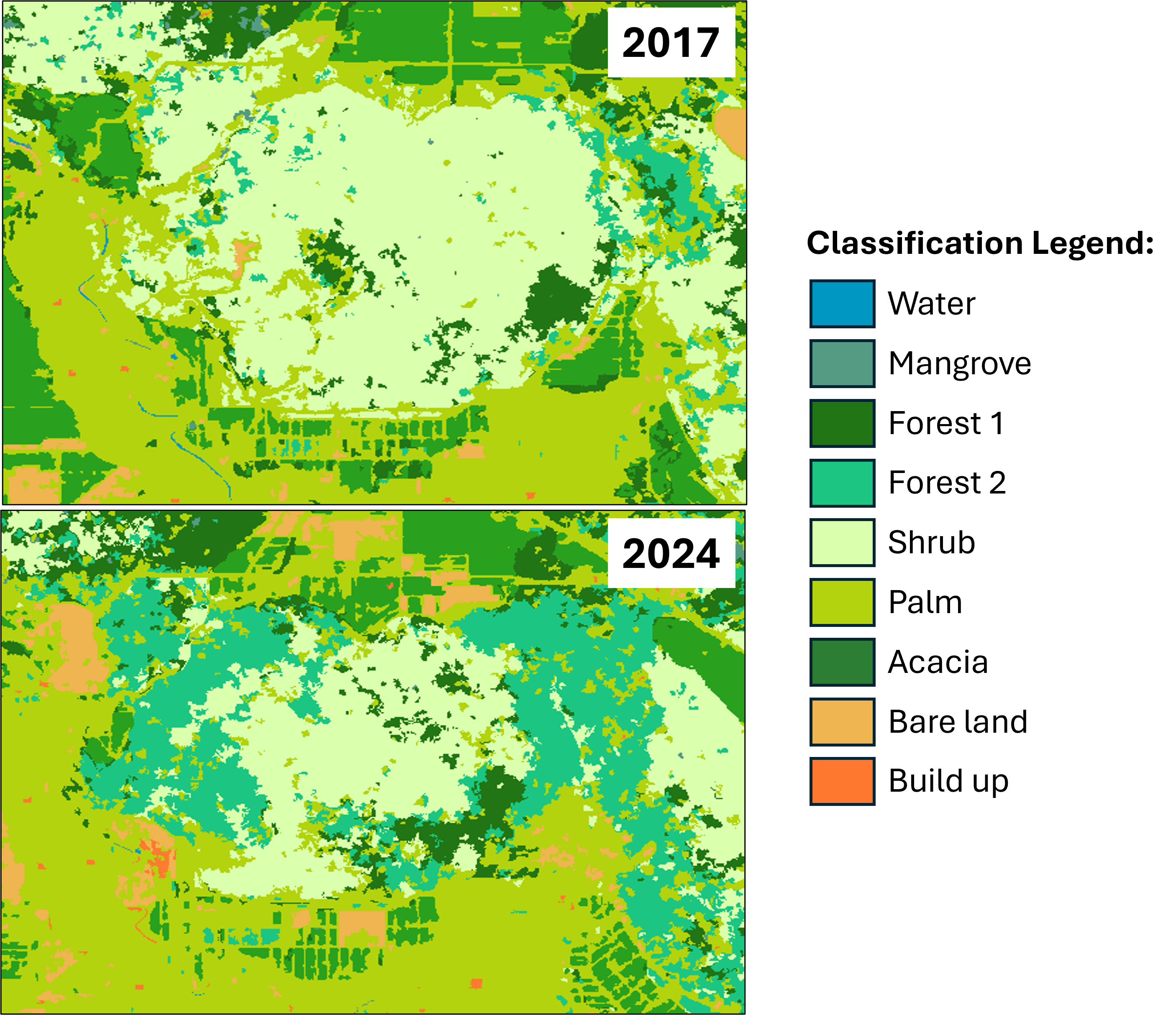
Second, there’s a quite remarkable increase in low canopy forest. Most of the low canopy forest areas appear to have changed from shrubs. The most significant increase happened between 2019 and 2024, which is the same period when the decline of high canopy forest slowed down or stopped. Both of these phenomena are likely the result of conservation and restoration efforts that are currently ongoing in the region.
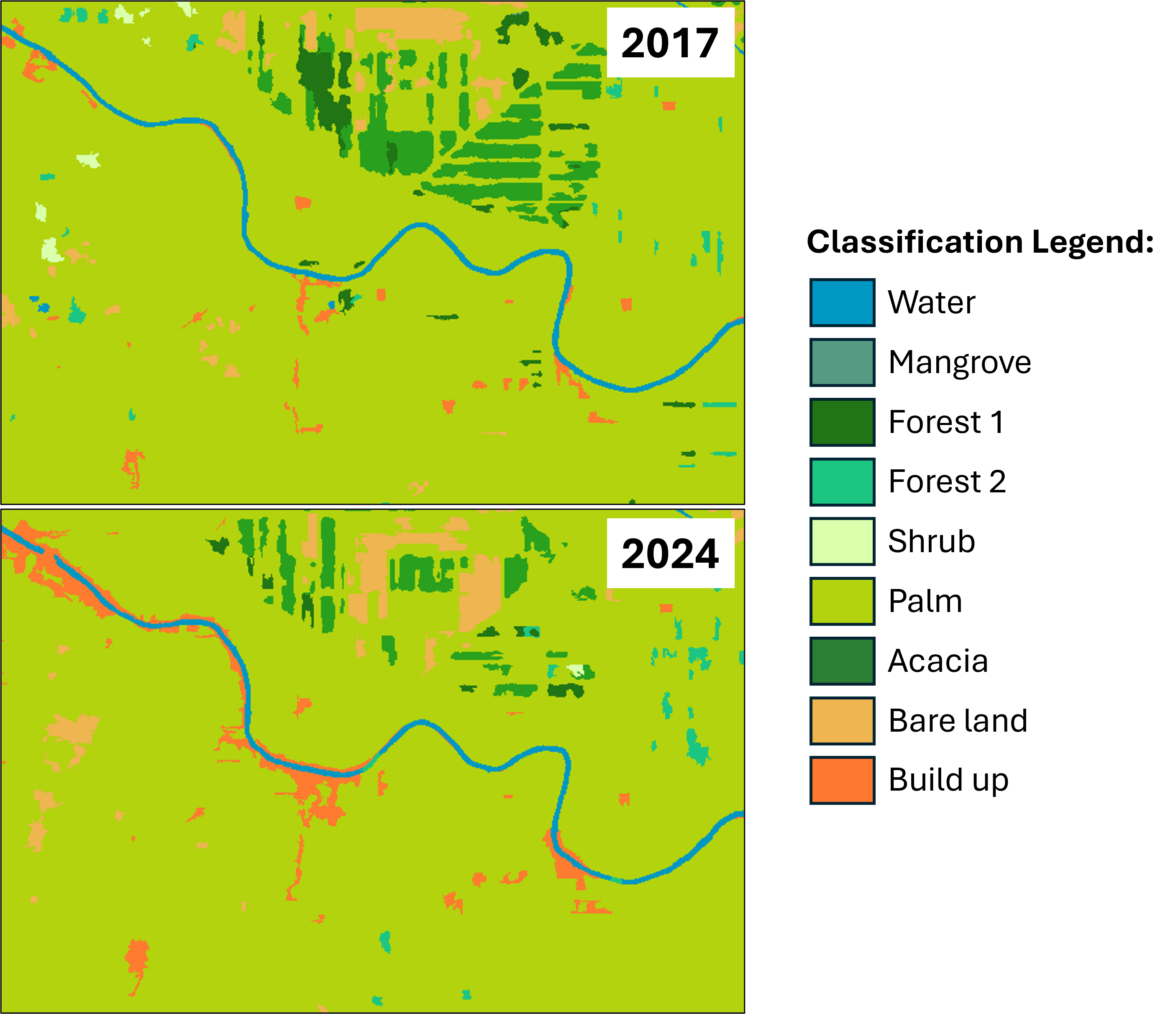
The final thing that stands out is the slow and steady increase in built-up areas. Most of the new built-up areas seem related to local community settlements in small towns or villages near riverbanks, and some appear to be plantation housing and factory sites.
This project shows how combining different sensors and using an object-based approach can produce accurate and insightful land cover maps. Beyond just the numbers, the patterns we see from year to year tell a deeper story about environmental change, pressure from human activity, and efforts to restore and protect our landscapes.
Enjoy Reading This Article?
Here are some more articles you might like to read next: